Erosion Control


Photo 171374827 © Joergspannhoff | Dreamstime.com

Photo 45833406 © Kenishirotie | Dreamstime.com

Photo 60969407 © Hin255 | Dreamstime.com

Featured
Featured
Wright Water Engineers
Photo 59441063 © Rawpixelimages | Dreamstime.com

Photo 126397652 © Kasto80 | Dreamstime.com


Photo 297187496 © Altitudevs | Dreamstime.com
Photo by Cameron McLeod, courtesy USACE.
Photo 39366702 © Gradts | Dreamstime.com

Photo 61631138 © Keechuan | Dreamstime.com

Photo by Jane Clark, courtesy USACE.
Photo courtesy New York State's Office of Governor Kathy Hochul.
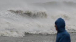
Photo by David Ruderman, courtesy USACE.
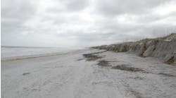
Photo 4743153 © Helder Almeida | Dreamstime.com